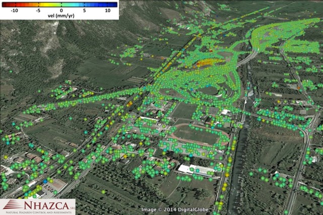
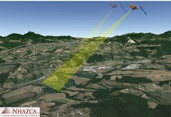
Radar Interferometry is the acquisition and interpretation of radar images to measure movement of the ground and structures for a variety of applications:
- Retrospective analysis - utilise data acquired by satellite since 1992 to identify historic movements.
- Long term deformation trend analysis over large areas (unlimited target size).
- Remote sensing eliminates safety and restrictive site access issues and allows immediate start to monitoring.
- High density of data points can be acquired providing flexibility to monitoring programme.
- Obtain valuable historic data to inform current and future engineering decisions; resolve long running disputes / claims.
- Radar data can be displayed on GIS and combined with other survey / monitoring data.